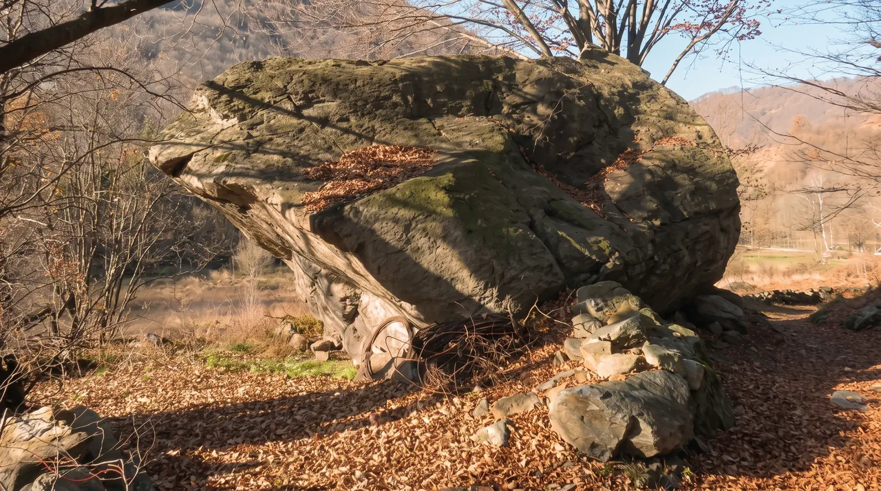
AIReworked with AI
What changed. Warm late-afternoon light and a pale blue sky with a few high clouds in place of the original light and sky. Readable signs, cars and people removed where present, filled with what was plausibly behind them. Buildings, shores, boats, trees and framing are those of the original; small distant details are rendered by the model and should not be read as a record.
Source photo: Nonio Masso erratico.jpg · Francoerbi
Licence: CC BY-SA 4.0 · Nano Banana 2 (Higgsfield) · 6/10/2026
83 min · 94 km · from Piazza del Duomo, by car
Nonio
The lake ends · Omegna to the north, Gozzano to the south: the small towns, services on foot
In one sentence
Nonio is the village overlooking the northern stretch of the west shore, 7 min from Omegna: 830 residents, 175 m above the lake, 83 min from Milan.
Data sheet
By car, without traffic
| From | Drive time | Kilometres |
|---|---|---|
| Milan | 83 min | 94 |
| Malpensa | 62 min | 54 |
| Linate | 1 h 31 min | 99 |
| Novara | 58 min | 56 |
| Turin | 1 h 44 min | 134 |
| Lugano | 1 h 30 min | 103 |
| Zurich | 3 h 55 min | 260 |
| Basel | 4 h 28 min | 317 |
| Bern | 4 h 09 min | 313 |
| Geneva | 4 h 02 min | 311 |
| Munich | 6 h 09 min | 471 |
OSRM on OpenStreetMap data, without traffic, measured on 6 October 2026. Arrival at the centre of the place.
elevation
465 m175 m above the lake · from 376 m to 641 m around the point
Copernicus DEM (GLO-90) for the point; Terrain Tiles for the surroundings (400 m radius). Ground elevation, not buildings.
Sun on 21 December
6 h 57 min of direct sun, from 08:28 to 15:24 (out of 8 h 28 min of theoretical daylight)
Our own calculation on the terrain (Terrain Tiles): only the mountains count, not buildings or trees.
Train, boat, schools
- Nearest station
- Pettenasco · 3.6 km
- Nearest pier
- · 0.7 km
- State schools in the municipality
- scuola infanzia
- residents
- 830 · ISTAT 1/1/2025
as the crow flies
Landslides and floods (municipality)
- of residents in high or very high landslide hazard areas
- 1.1%
- of residents in medium flood hazard areas
- 0.9%
ISPRA IdroGEO, percentages for the whole municipality (2021 census population), not for the point.
Distances
Nonio and its neighbours
| Places | Drive time | Kilometres |
|---|---|---|
| Omegna | 7 min | 5.6 |
| San Maurizio d'Opaglio | 11 min | 10.0 |
| Pella | 12 min | 9.4 |
| Madonna del Sasso | 15 min | 11.5 |
| Quarna Sopra | 16 min | 11.0 |
| Ronco | 17 min | 12.3 |
| Pettenasco | 18 min | 13.1 |
| Armeno | 18 min | 13.3 |
| Gozzano | 18 min | 15.4 |
| Bolzano Novarese | 18 min | 16.8 |
| Legro | 21 min | 16.4 |
| Vacciago | 21 min | 19.1 |
| Miasino | 22 min | 16.1 |
| Orta San Giulio | 23 min | 16.9 |
| Ameno | 24 min | 20.0 |
OSRM without traffic, measured on 6 October 2026. On the lake the road goes round the water: from one shore to the other the car takes longer than the boat.

How life is
Living in Nonio
A village above the shore, close to town
Nonio lies at 465 m, 175 m above the lake and about 650 m from the shore as the crow flies, on the western slope of the northern stretch. It has 830 residents (ISTAT, 1 January 2025; 2026 estimate: 820) and is in the province of Verbano-Cusio-Ossola. According to Wikipedia there are serpentine quarries in the municipality.
Its strength is its position: Omegna, with schools, a station and town services, is 7 min by car; San Maurizio d'Opaglio 11, Pella 12.
Services in Omegna
The municipality has a state nursery school; primary, lower and upper secondary are in Omegna. For healthcare, Omegna has a first-aid point, not an emergency department; the ASL VCO level-I emergency departments are in Verbania and Domodossola.
The nearest boat landing in OpenStreetMap is about 700 m away as the crow flies; scheduled boats run from March to October, and from November to February no service is listed.
A steep slope: landslides and sun
According to ISPRA, 7.6% of the municipal area has high or very high landslide hazard: the highest share among the atlas's municipalities, though it concerns 1.1% of residents, because the steep ground is largely uninhabited. 0.9% of residents live in areas of medium flood hazard.
On 21 December our calculation gives 6 h 57 min of direct sun, from 8:28 am to 3:24 pm: 18 minutes more than Piazza Motta, with morning sun. To the west the mountain behind closes the horizon up to 27°, and on 21 June the sun stops at 12 h 27 min. The calculation covers terrain only.
What you buy and at what price
According to OMI (2nd half of 2025), in the built-up centre (B1) standard homes are valued at €900–1,350/m², villas at €1,000–1,450/m², economy homes at €600–850/m². In the rural mountain zone R1 only economy homes are valued, at €450–600/m². Against the 2nd half of 2024 standard homes rose by 2.3% at the midpoint; villas are flat.
These are among the lowest values on the lake, close to Madonna del Sasso. They are valuations, not sale prices: ranges estimated by zone and type, on gross floor area and normal condition.
Getting there
By car, without traffic: 83 min (94 km) from Milan's Duomo, 62 min (54 km) from Malpensa T1, 90 min from Lugano. The handiest station is Omegna, 4 km away as the crow flies and 7 min by car, on the Novara–Domodossola line; for Milan you change at Novara. Pettenasco is closer as the crow flies (3.6 km) but on the other shore.
By car, without traffic · OSRM on OpenStreetMap data, measured on 6 October 2026.
Quotations
What the quotations say in Nonio
| OMI zone | Type | €/m² | Rent €/m² per month | Change on 2024 |
|---|---|---|---|---|
| B1 · centro abitato Centrale | Abitazioni civili | 900–1,350 | 3.0–4.4 | +2.3% |
| Abitazioni di tipo economico | 600–850 | 2.4–3.2 | +3.6% | |
| Ville e Villini | 1,000–1,450 | 3.2–4.6 | 0.0% | |
| R1 · rurale montana Extraurbana | Abitazioni di tipo economico | 450–600 | 1.6–2.4 | +5.0% |
Italian Revenue Agency, OMI, 2nd half of 2025, normal condition; change on the 2nd half of 2024. These are estimated ranges per zone, not individual sale prices.
Honestly
Does Nonio suit you?
It suits you if
- You want to live above the lake with Omegna and its services 7 min away.
- You are looking for low values: standard homes at €900–1,350/m².
- Morning sun is enough for you: on 21 December it arrives at 8:28 am.
Look elsewhere if
- You need schools beyond nursery in the village.
- A steep slope worries you: 7.6% of the municipality is in a P3–P4 landslide area.
- You want tourist-village life, with a piazza and a lakefront.
Questions
The questions we are asked
How much does a house cost in Nonio?
In the built-up centre OMI values standard homes at €900–1,350/m² and villas at €1,000–1,450/m² (2nd half of 2025). In the rural mountain zone economy homes are at €450–600/m². These are estimated ranges, not signed prices.
Is Nonio at risk of landslides?
According to ISPRA, 7.6% of the municipal area has high or very high landslide hazard, but only 1.1% of residents live in those areas. The figure is municipal: check the individual plot on the PAI and zoning maps.
How far is Nonio from Omegna?
7 min by car without traffic. Omegna has schools up to upper secondary, the station and the first-aid point. For a full emergency department you need Verbania, Domodossola or Borgomanero.
How much winter sun does Nonio get?
On 21 December, 6 h 57 min of direct sun, from 8:28 am to 3:24 pm, according to our terrain calculation. The slope faces east: morning light, early sunset behind the mountain. Buildings and trees are not considered.
Can I buy here through OrtaVillas?
Yes: TriesteVillas srl is a registered agency and can act as broker on the lake. Today, however, the lake's Private Collection has 0 homes, and this page is not a listing. Sign up to be notified, or write to richieste@triestevillas.com or call +39 347 8628738.
Private Collection · Lago d'Orta
Tell me when homes in Nonio arrive.
Today the lake collection is empty: leave us an address and your areas, and we will write when the first home arrives.
Do you own a home in Nonio? This is how we would present it →
Sources
- ISTAT – Popolazione residente al 1° gennaio 2025 (POSAS) · read on 2026-10-06
- Agenzia delle Entrate – OMI, quotazioni 2° semestre 2025 e 2° semestre 2024, Nonio · read on 2026-10-06
- OSRM su dati © OpenStreetMap contributors – tempi in auto senza traffico · read on 2026-10-06
- ISPRA IdroGEO – indicatori di pericolosità, comune di Nonio · read on 2026-10-06
- MIM – Anagrafe scuole statali a.s. 2026/27 · read on 2026-10-06
- Sole al 21 dicembre, marzo e giugno: calcolo OrtaVillas su AWS Terrain Tiles (EU-DEM/SRTM) · read on 2026-10-06
- Quota: Copernicus DEM GLO-90 via Open-Meteo Elevation API · read on 2026-10-06
- Wikipedia (it) – Nonio (cave di serpentino nel territorio) · read on 2026-10-06
- OpenStreetMap (Overpass) – imbarcaderi del lago, estratto del 6/10/2026 · read on 2026-10-06
- Navigazione Lago d'Orta – orari 2025 e 2026 · read on 2026-10-06
- ASL VCO – Punto di Primo Intervento di Omegna; DEA di I livello Verbania e Domodossola (BUR Piemonte 20/7/2026) · read on 2026-10-06